Spatial Analysis
Level one of this analysis shows possible suitable areas in the whole GVRD where wind turbines may work. As seen below, The lighter green areas are the most suitable. 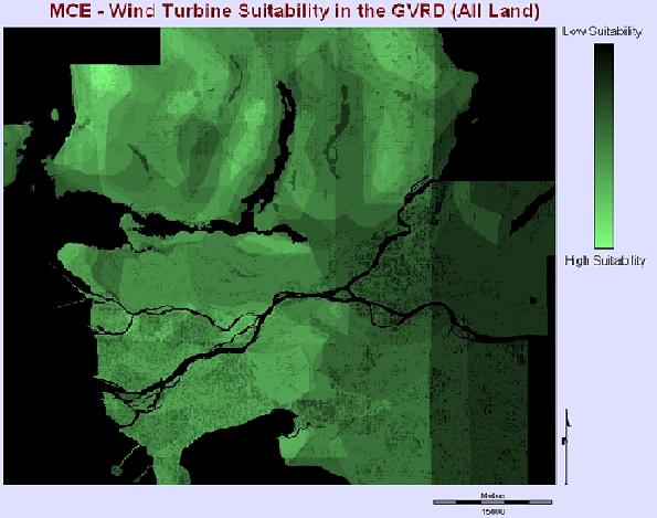
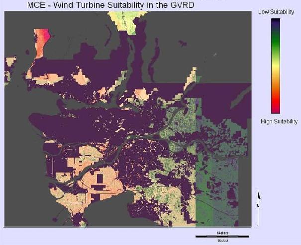
Level 2 of this study shows a more realistic view of where turbines may work. (only on agricultural and open/undeveloped land). The most efficient place to put a small turbine is the strip of land on the west coast of West Vancouver running north from Lions Bay up the coast along the Sea-to-Sky Highway.
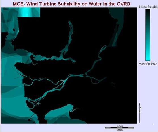
The final stage below, level 3, shows where floating turbines would be successful. As in both the above maps, the area around the Howe Sound Inlet, just to the west of Lions Bay and the beginning of the Sea-to-Sky Highway has the highest winds.
The below image was used in the MCE. The legend output describes the different levels of wind speed. Only areas in the orange and red color range have enough wind to create energy through a small wind turbine. The highest area shown in pink is in the Howe Sound Inlet, between the east coast of Gambier Island and the West Coast of West Vancouver. 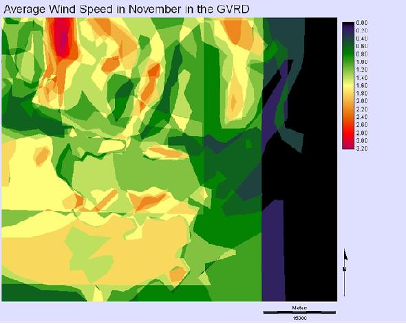
The first wind turbine investigated has a Cut-In Speed of 2.5m/s which is equal to 2.2 on the legend scale. The darker orange regions have enough wind to efficiently create electricity through the ARE 110 Wind Turbine.
The second wind turbine investigated has a Cut-In Speed of 3.5m/s which is equal to 3.15 on the legend scale. Only a very small area in the Howe Sound Inlet will efficiently create electricity through The Aerostar 6 Meter Wind Turbine.
See the digitized wind maps here