

As stated on the previous page in Methodology, weighting was important in the finished product, the visualization of the worst areas to have a car.
Below is the final product of our Multi-Criteria Evaluation (click here for an uncompressed version):
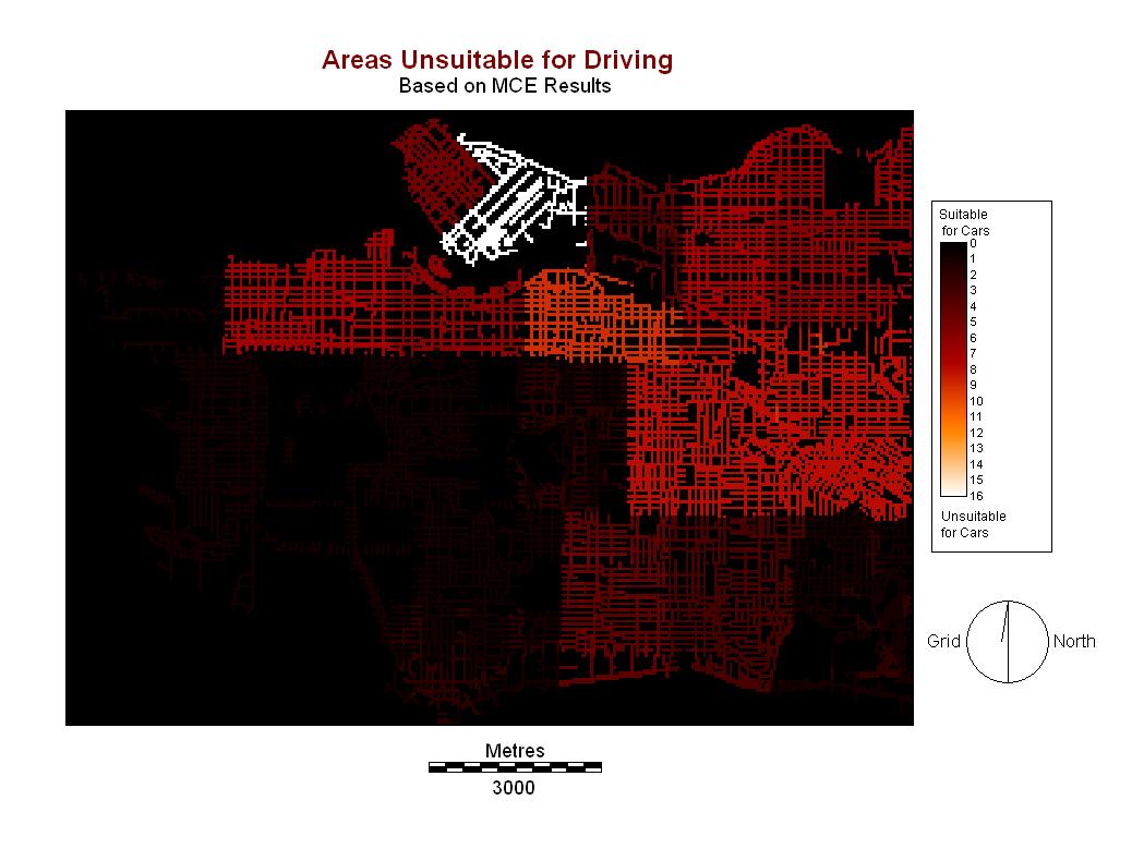
With our list of input factors we have determined the most suitable and unsuitable areas for driving and/or parking a car. The scale has been broken down into 16 categories, where 16/highest value denotes an area most unsuitable for having a car and 1 denotes an area where it is most suitable to drive or park a car. 0 denotes an area not included in the analysis. This includes anything that is not a street (water, housing, parks, etc).
From the output of the MCE we see that the area known as the Central Business District of the city has the highest degree of unsuitability while areas like Dunbar, Oakridge, Shaughnessy and Arbutus had the lowest degrees of unsuitability. Below we can see the names of each neighborhood and how it corresponds to our output file: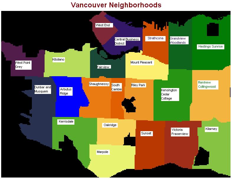
Our output file shows that areas surrounding the downtown core of Vancouver also show high areas of unsuitability. These areas include Kitsilano, Fairview, Mount Pleasant.
Spatial analysis also indicates that unsuitability is higher in areas of Vancouver which are more densely populated. Outlying areas to the south and west tend to be sparsely populated with large private properties. A high degree of unsuitability also extends east-southeast of the central business district which possibly reflects the amount of daily traffic which heads downtown in to the Central Business District. 
Our main conclusions based on the output are as follows:
While our finished product gives us some conclusions on the areas of unsuitability for automobiles there are some issues and factors to take in to consideration that may have affected the outcome of our project. This can be found in the Discussion section.
You can also return to the Top of the Page
