
A fuzzy layer was standardized for values between 0 and 255. Parklands were given the top priority of 255 for replanting, because of their importantace to the commuity and environment, as well as their severly decreased likelyhood of being destroyed for development of forestry in the future. This is why agricultural and developed areas were considered as factors.
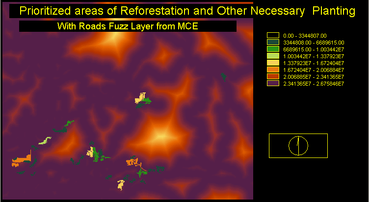
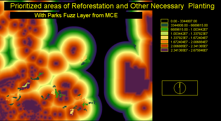
These constraints used a multiplication overlay that isolated the areas where reforestation or other new vegeation was needed.
It was decided that slope would not be a factor in the analysis for two reasons. The first being because the slope was not great enough to justify it's inclusion in the project. The second being that treeplanters can replant very steep terrain, and it is doubtfull that any terrain steeper than this threshold would have any significant vegetation crucial for reforestation.
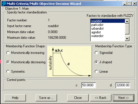
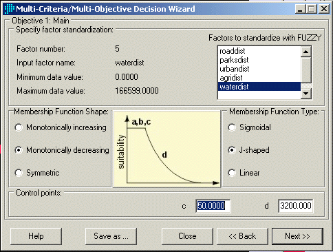
Roads also acted as a factor in the analysis. This was because of two functions the road holds. Replanting is especially important near roads for the prevention of erosion, as well as allowing easier access to areas in need of replanting. The roads were given a j-shaped decreasing curve with values of 50 to 3200. This is because at a very close range the vegetation prevents erosion along roads, gradually decreasing in value although still important in terms of access.
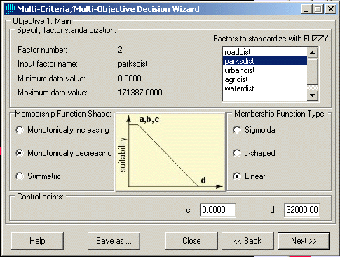
Parks were standardized at linear decreasing because the farther away from the centre of the park the lower the suitability. A range of 32, 000 to 0 was used for control points.
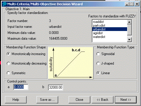
Urban and agricultural areas are both increasing linear because both increase in suitablility as the distance away from them becomes greater. This is because vegetation near agricultural areas and urban areas are more likely to undergo development such as urban sprawl than areas very far from human settlement.