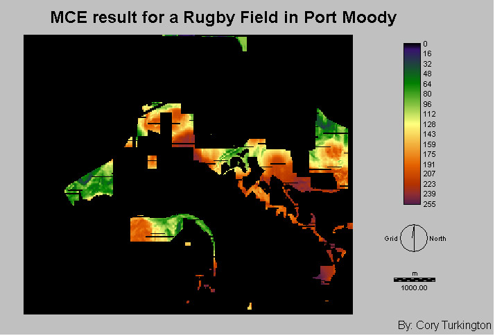
Results of the MCE: Non-Boolean
Standardization and Weighted Linear Combination used for locating the
ideal location for the construction of a rugby field in Port Moody.
Initial image that was created
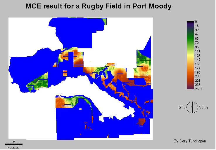
Overlay of MCE evaluation on the
municipal boundary of Port Moody
Reclass of MCE Evaluation to make
the image more readable
The above images are the results of MCE that
was done. One criteria that I wasn't able to
acquire was future development. This criteria would have been
beneficial, because
it would have eliminated a number of sites from the final image. For
example in the north east section of the map there is a large area that
has been considered most suitable for development. However there is one
problem a large portion of this land is owned by land developers and
this land is slated to be an expansion of the existing Heritage
Mountain area. In other words this land would not be suitable for a new
field. The most obvious site for the location of a rugby field is in
the north west corner of the map. The area is easy accessible as it is
located near Ioco Road, which is the main road on the north side of
Port Moody. There is plenty of available land for construction. In
addition it is located near a school. Unfortunately there is now pub
within the area, but the other factors make up for this.
In conclusion the ideal location for a rugby field
would be at the corner of Ioco
Road and East Road (northwest Port Moody).