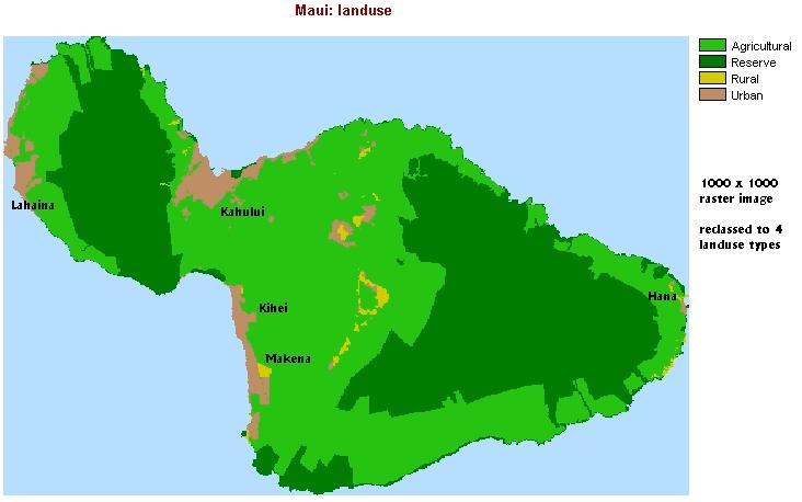
| The landuse is useful for the study of coastlines. Urban areas have the highest population density and intensive use of beach resources. However, not all urban areas have the same beach resources. The city of Kahului is the main local population center and has the international airport. Most tourist resorts and beaches are located along south-west coasts at Kihei and Makena, and also north of Lahaina. The town of Hana is more isolated. |
| This raster image was produced in IDRISI. Landuse polygon coverage
was imported from ArcView shapefile into IDRISI raster file.
Landuse codes are: (1) agricultural, (2) conservation, (3) rural, (4) urban
shapefile ------ (import) ------> Maui_Landuse.vct -----
(POLYRAS) ------> Maui_Landuse.rst
|
| Problems:
The vector file has 161 categories (one for each polygon) - tried different tricks for importing it from ArcView shapefile but it never assigns the proper landuse codes to polygons; also, an error message comes up when attempting to display one field (land use code - integers 1 to 4) as separate vector layer. - this happens on some of the computers but it works on others - software problem! Export landuse values to attribute value file: landuse.avl create new image: Maui_Landuse.rst ----- (ASSIGN)
-----> Maui_Landuse2.rst
|