Spatial Analysis
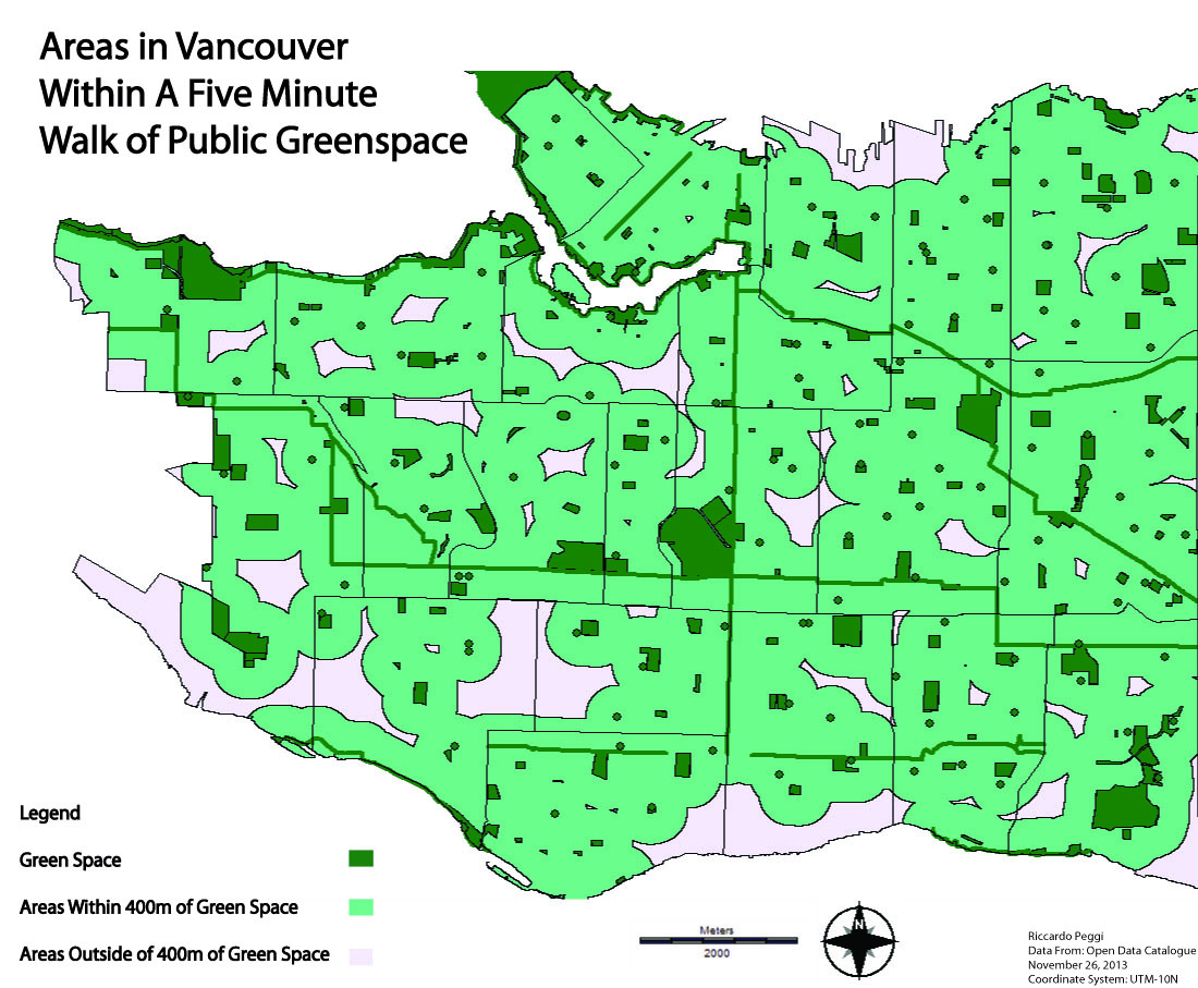
Here is the final output of my project:
Figure 1
Discussion
According to my analysis, about 6.9% of Vancouver is covered by public green space and 73.5% of Vancouver land is within 400 metres of that green space. From the output map produced, several large areas in Vancouver are outside the “5-minute walk zone” (Figure 2). For these areas, I will provide a closer inspection as to why they are outside the zone and what can be done so that these areas are within the “5-minute walk zone”. In a city like Vancouver, it can be tough to find ways of building parks when so much of the land is already developed and privately owned.
Figure 2
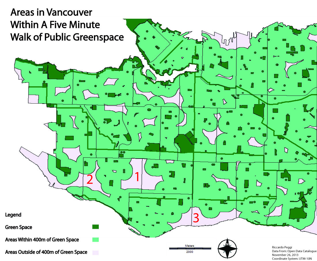
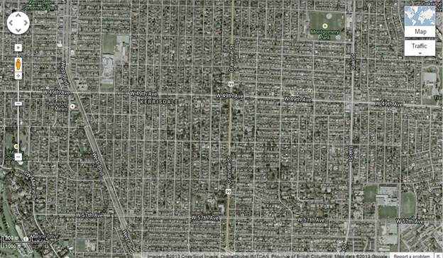
1) Space between Kerrisdale and Oakridge (Figure 3)
This space in central Vancouver is predominantly a residential zone with single family housing. Though it is covered with green space in front and back yards, it is far from public green spaces like Montgomery Park (top right), Winston Churchill Secondary (Bottom Right) and Magee Secondary/Maple Grove Elementary (Top Left). Due to the prominence of single family housing, it may be very tough for the city of Vancouver to create public green space in the area as the land is divided up between so many people. Therefore, it would be very difficult to find even half a block to build a park. However, a possible solution around this could be to construct a greenway on one of the side streets off Granville, perhaps leading to one of the schools. The issue with a greenway being that in an area of single family homes the car tends to dominate as a mode of transport so residents may not be in favour of a greenway taking over a street. A second possible solution could be building a community garden in a vacated lot. A community garden can be smaller than half a block so the city would have to buy/find less land to build on. Though, questions have to be asked whether the neighbourhood would want the responsibility of a community garden and the city still has to buy the land which is very costly in Vancouver.
Figure 3
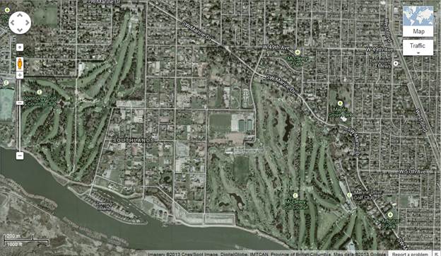
2) Space between Kerrisdale and Dunbar-Southlands (Figure 4)
This space is oddly left out of the 5-minute walk zone because it is dominated by green space. The reason it is left out is because the green space in the area is private land in the form of two golf courses (McCleery Golf Course and Point Grey Golf and Country Club). The city has three plausible options to work with in the area: create a park in between the two golf-courses, redefine the definition of public space or ask either golf course to siphon a small portion of their land to be made public. Building a new park in between two golf courses would be an expensive option and the city could find a more economic way to create public land in the area. If the City decides to redefine the definition of public space in the plan then they may be criticized by the public for “cheating”. Arguably, though, golf courses are still green space that can be looked at but perhaps not used freely by the public. The last option would be to siphon off a piece of the golf course for public space. This could mean perhaps a bike path or walkway around the outside of the golf course which would not cost the city too much compared to a new park as the green space is already built and maintained by the golf course.
Figure 4
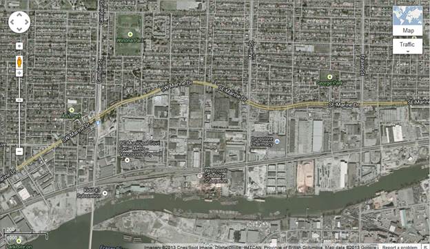
3) South Marpole (Figure 5)
South Marpole is an area that is covered with industrial lands so it is not technically included in the goals in the Greenest City 2020 Action Plan since it specifies that people should live within 5-minutes of a public green space. However, that being said, the city should still be creating public green spaces in these areas as amenities for workers. In a highly stressful environment such as industrial lands a park could be a good place for people to spend their breaks. Perhaps I am being idealistic though as Vancouver still needs to focus on creating green space in pocket of land that are outside of a 5-minute walking distance of existing green space. Perhaps industrial lands could be in a following sustainability plan.
Figure 5
Images taken from Google Maps