| Home | Introduction | Data sources
|
Methodology
|
Cartographic Model | Conclusion |
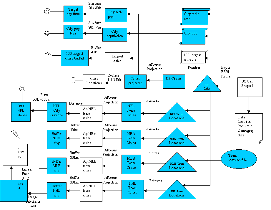
This is a Visual of the cartographic model To get a more in depth view of the model click on the image and if you have Microsoft word you can explore the cartographic model. In the word doc you can click on the coloured steps to view images produced and data sources used City Cartographic model |
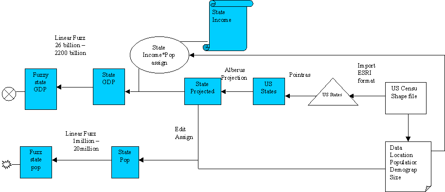
| State
Cartographic model |
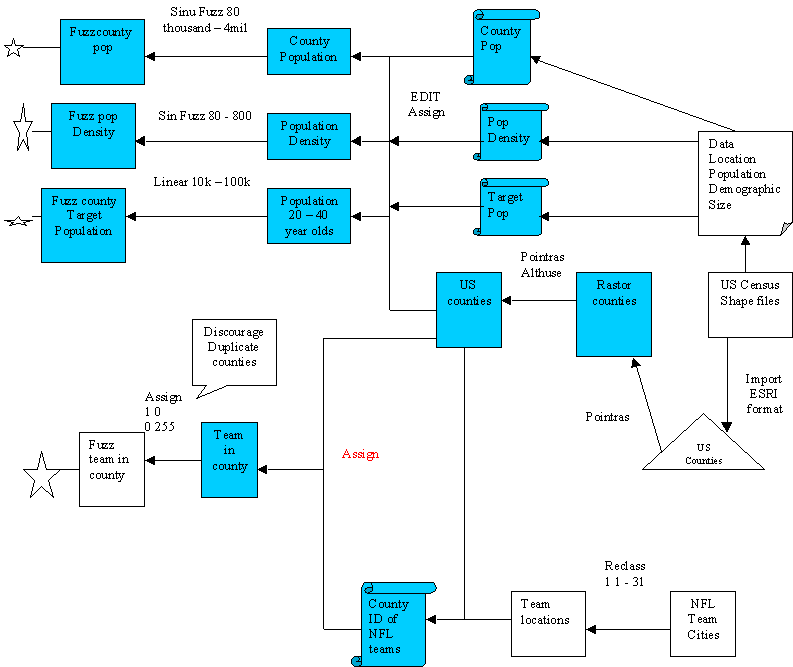
| County
Cartographic model |
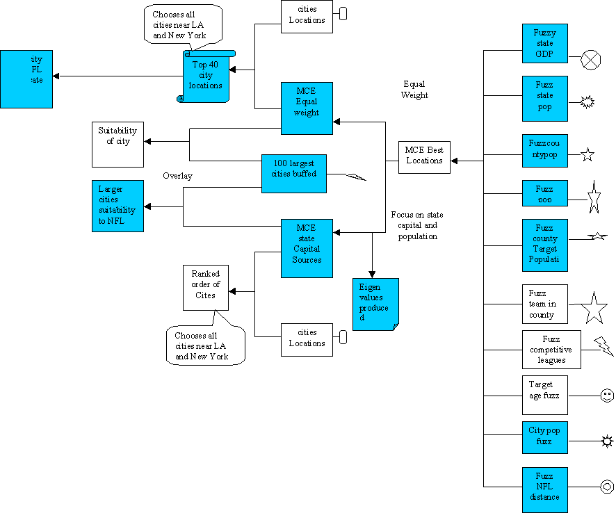
| Cartographic
MCE |
| Home | Introduction | Data sources
|
Methodology
|
Cartographic Model | Conclusion |