After extensive data preparation, analysis and enhanced cartographic products, I am able to answer my orginal question of "Where do we put our store?" The answer, according to the maps, depends on whether or not I want the skytrain to be an option for getting there. Considering the new line is opening soon, and I don't own a car, I will answer my project question from the map with the Skytrain considered. In regards to not being able to incorporate the new Skytrain line into my analysis, I would eventually incorporate it into my project as soon as I acquired accurate spatial data for it.
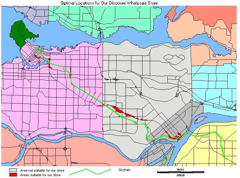
The areas that were depicted in my map as being suitable were New Westminster, Metrotown, near Joyce Skytrain Station, Commercial and Broadway, Main Street near Science World, and Yaletown. There are a few other single zone locations indicated as well.
These results tied in with what I expected and then some. I was not expecting, nor even thinking about the possibilty of the Main or Commercial Streets venues. Also, my prediction that there wouldn't be any locations identified in the eastern parts of the GVRD was correct; hence, my map only covers Vancouver and Burnaby. This level of analysis certainly is sufficient for inital considerations, but to define specific addresses, we would need some detailed zoning and leasing information. With that data, we could take this analysis even further ahead to narrow down the possiblities.
Once again, GIS software needs to have a better graphics package built in for producing decent final analytical maps. Having to load all of those maps into another graphics package became tedious after a while!