Waterbodies
This operation was committed
to identifying all water bodies to make them a constraint for the multi-criteria
evaluation. They are considered a constraint because they would not
be acceptable locations for a wheat farm.
Methodology
-
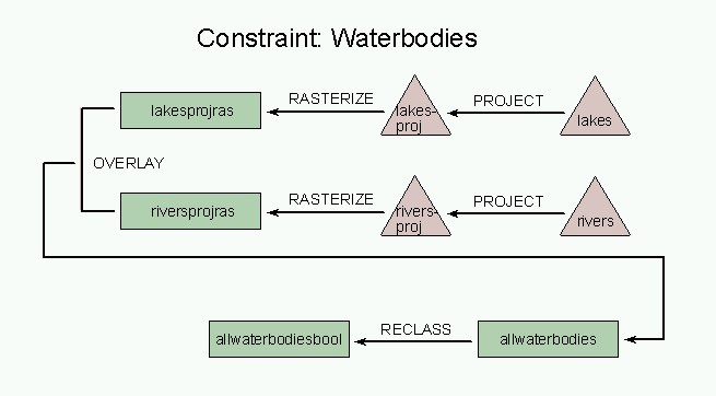
I had unprojected river and lake data in vector format,
so I first used the PROJECT module on each file which I called "lakesproj"
and "riversproj".
-
I then rasterized them using original raster data
from my base image "aprcann2", calling it them "lakesprojras" and "riversprojras".
-
I used OVERLAY on "riverprojras" and "lakesprojras"
to give me "allwaterbodies".
-
I performed a boolean operation on both files to
simply identify the location of each waterbody.
-
I used EDIT and ASSIGN to create a boolean image
on "allwaterbodies" and produced "allwaterbodiesbool".
Back to Methodology and Spatial Analysis
or
Forward
to Next Parameter