 DATA MANIPULATION
Index
Page
Background
Methodology
Data Collection
Data Manipulation
Spatial Analysis and Result
Problems
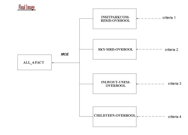
Base on the four criteria, I need to generate at least four map to produce the final map.
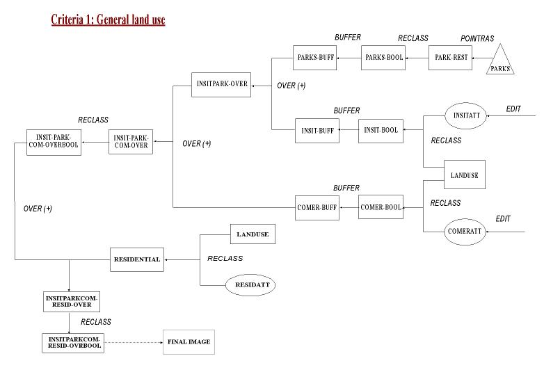
Criteria 1: General Land use
When doing the buffer zone for school and public parks,
I set a higher factors of 500 meters and the buffer zone for commercial
as 250 meters. Since schools and parks are more important, so I first
overlay the two maps and then add the third layer of commercial map.
Then I overlay add the last component of residential layer and generate
the last map for this criteria. This will later combine with other
three criteria to generate the final images on best location for homeless
shelter.
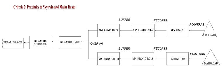
Criteria 2: Proximity to Skytrain and Major Roads
From the given
data sources, there are no public transit system for the whole GVRD area.
The only data I could get is the main roads which I assume that most of
them have public transit route. The data sources problems
might cause some error but I think it is still very limited. I set
a 150 meters buffer zone for the skytrain and main road before overlay
the maps. The resulting map will be use for the final MCE procedure.
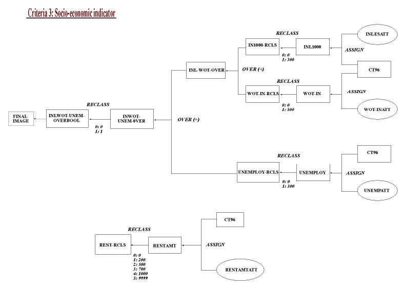
Criteria 3: Socio-economic indicators
When doing the reclass on income less than $1000 and
without income, I set the cut off number to 300 and 500 respectively. Then
I overlay this two map first. The unemployment reclass is also to
300 and then added to the pervious income map. This map will use to the
final MCE procedure. The individual map of average gross rent also
done by reclass with 5 classes.
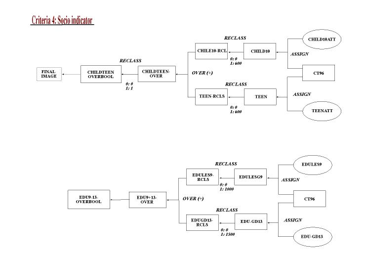
Criteria 4: Social indicator
The reclass on children under 10 and teenagers are
both set to 600 and then I overlay the two maps. The other map on
education level also go through the reclass, education less than grade
9 is set to 1000 while education up to 13 only is set to 1500. This
is only a supporting reference map so I do not need to overlay the two.
Only the children and teenagers map is set ready to the final MCE procedure.
Final procedure: I use the MCE function to combine
above four maps and calculate the possible best area for homeless shelters.