Methodology
My methodology was pretty straight forward when I started my project.
But as you will see in my cartographic model I ended up with a lot of confusing problems and a
different result as I wanted to.
The reasons for that will be discussed in the problem section. Also the model itself includes some
problematic issues and explanations because I was thinking that it is more obvious this way what was
happening.
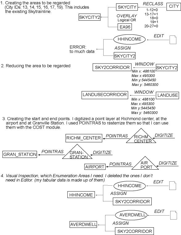
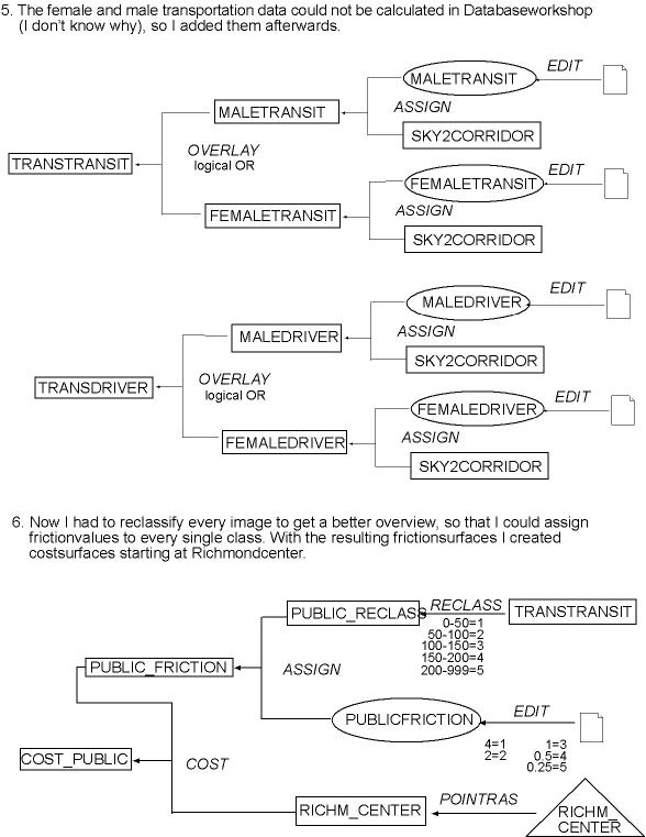
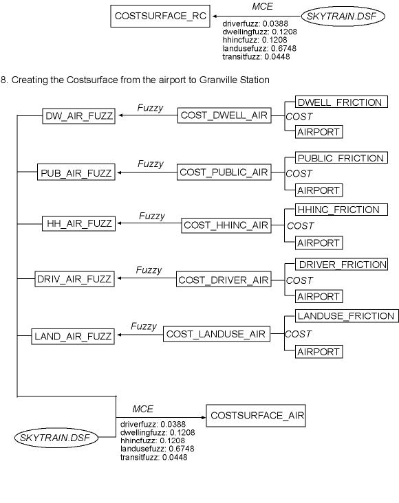
First of all I had to create the basic images I wanted to use for my analysis.
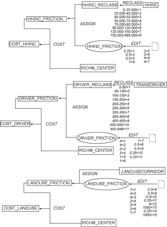
Then I reclassed them to get an overview over the area to decide by a visual inspection, which friction values I
want to assign to each class.
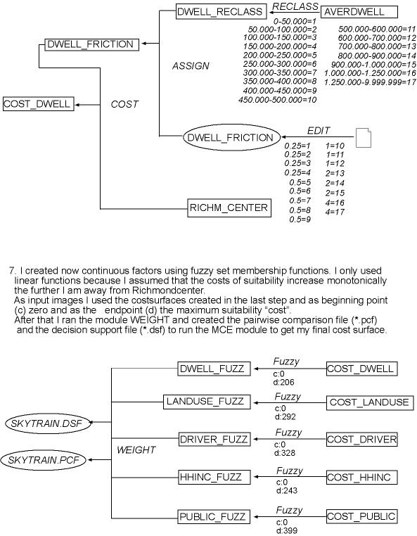
With the COST module I got my first five Costsurfaces.
By using the module FUZZY I created the prerequisites to run the module WEIGHT to weight each of the
"fuzzy images" (WCL Matrix).
The resulting pairwise comparison file and decision support file were used in the module MCE to get my final
costsurfaces (Richmond Center and Airport).
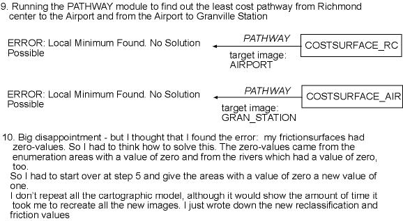
After that I ran the module PATHWAY to calculate a path from Richmond to the Airport and from the Airport
to Downtown.
Both were without a result.
You will see the steps I undertook to solve this problem beyond and in the Problem Section.