| Tick Coordinate Registration | ||
|
|
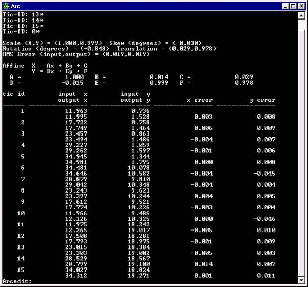
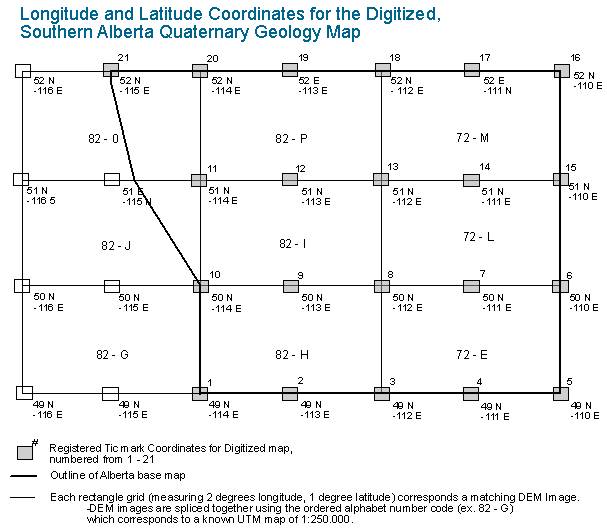
The initial master tick coverage was digitized as accurately as possible as these ticks would be used as the foundation for every digitized coverage of the study area. The subsequent digitizing coverages then had to be registered and coordinated with the master tick coverage files, so as to generate the lowest RMS error as possible: the lower the RMS, the better the coordinate matches are between the master coverage and the new coverages that were created. Two master tick coverages were made, registered to known latitude and longitude coordinates found on the base map. The first master tick coverage, ticcov, was used to create alberta3 and johnbrendan. The second reference tick coverage, ticcoverage, was used for the coverage north and consisted of the top section of the base map. In total, fifteen tick mark coordinates were created (numbered 1-15) for ticcov and sixteen (numbered 6-21) were created for ticcoverage.
|

