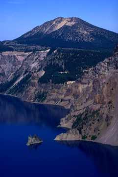
Mt. Scott
Mt. Scott, as viewed from Garfield Peak.
Photo credit: William L. Sullivan
Mt. Scott, at 8929 feet, is the tallest peak in the park (Uhler, 2002). According to the USGS (2003), the oldest lava flows in the park emanated from Mt. Scott around 400,000 years ago. These fine textured lavas consist of dacite and andesite. (At the lake level, there is also lava of the same age near Phantom Ship).
The trail is a strenuous 1500 foot climb covering a distance of 2.5 miles, that begins at 7450 feet. The average time to complete this climb is three hours. The trailhead is located on Rim Drive, fourteen miles east of the park headquarters. The first half mile from the trailhead is on a gentle grade, through stands of Whitebark Pine. After that, the trail steepens, but switchbacks help to moderate the grade. Then, the trail straightens out again and aims straight to the summit. Being the highest peak in the park, Mt. Scott offers the best panoramic view of the landscape, including Crater lake to the west, Mt Thielsen and the Three Sisters to the north, and Mt Mcloughlin and Mt Shasta to the south, and the Klamath Basin to the east. There is also a historic fire tower at the summit.
Click HERE to see the trail map!
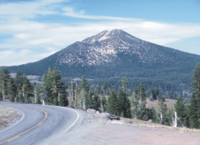
Mt. Scott, as viewed from Rim Drive.
Photo credit: Ed Klimasauskas
Views from the top:
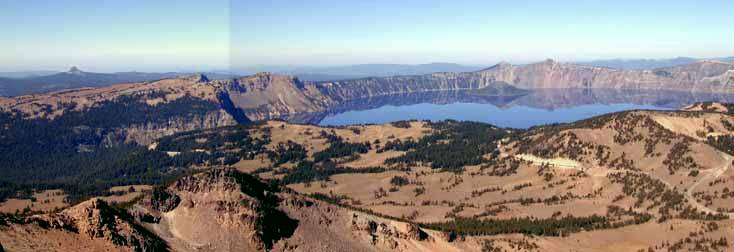
A panoramic view of Crater Lake.
Photo Credit: Wayne Deeter
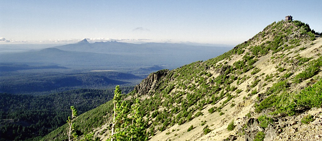
Mt. Scott's summit, with the historic fire tower, on the right. Mt. Thielsen rises on the left.
Photo credit: Carol Paral