Constraints for MCE (Population Density and Average Income)
1. Population Density
Procedures:
Step One:
Only table 1 is needed to calculate the population density, just I highlight its column then converting it from the file type: .mdb (Microsoft Access Database) to .dbf (dBaseIV) in Export to DBF in Microsoft Access program.
Step Two:
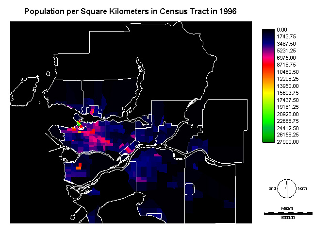
Then, opening Microsoft Excel and change the file: ct96_data_table1.dbf to table1.xls (where go to Data, select Export External Data and Import Data, then save the file type as .xls). In order to get population density, I divide the "Population" column over the "Land Area in Square Kilometers" column in Excel to obtain the number of people per square kilometer.
Step Three:
After that, highlighting the population column, then copying to Words and pasting into Edit (.avl) from IDRISI.
Step Four:
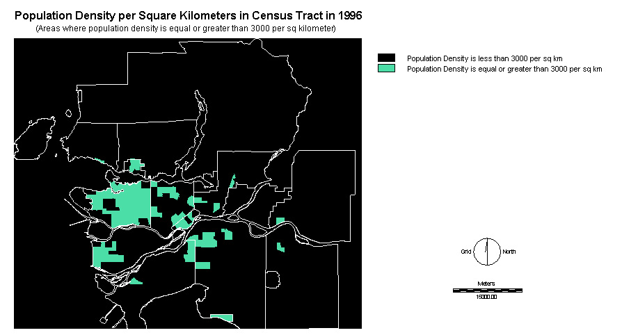
Finally, doing RECLASS (where assign the values as 0 is 0 to 3000, and 1 is 3000 to 279000) with attribute value files (.avl) from Edit.
-see Cartographic Models for the process of running the MCE
2. Average Income
Procedures:
Step One:
In fact, the procedure is similar to Population Density as above, for instance, to converting file (use table 130) from .mdb to .dbf in Microsoft Access program.
Step Two:
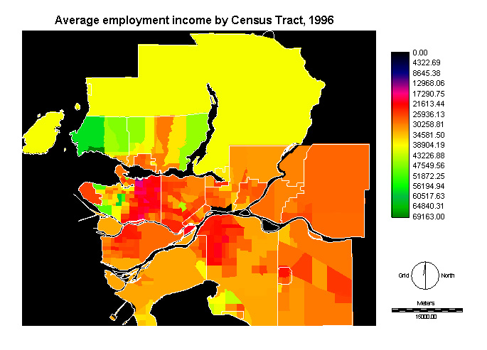
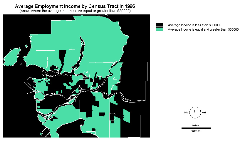
Then, I highlight the Income column and copy to Words and paste to Edit in IDRISI. Finally, I apply RECLASS (where I assign 0 to values <$30000 and 1 to values>$30000) with attribute values.
Step Three:
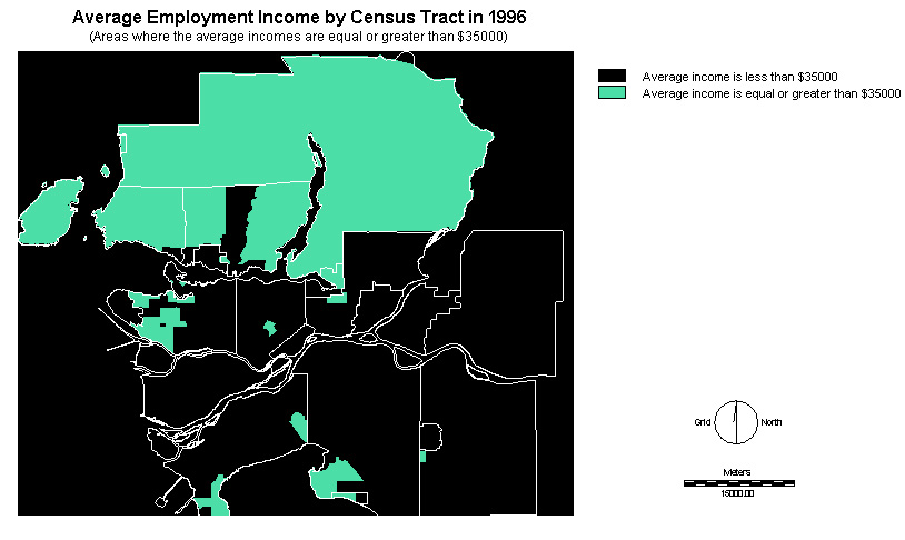
Then I do RECLASS again (assign 0 to values <$35000 and 1 to values >$35000) to create a second average income layer with the threshold at $35000.
Step Four:
As a result, there are two layers of the average income to be applied for MCE.-see Cartographic Models for the process of running the MCE
Factors for Both WLC and MCE (Competition, Hotels, Landuse, and Major roads)
3. Competition
Procedures:
Step One:
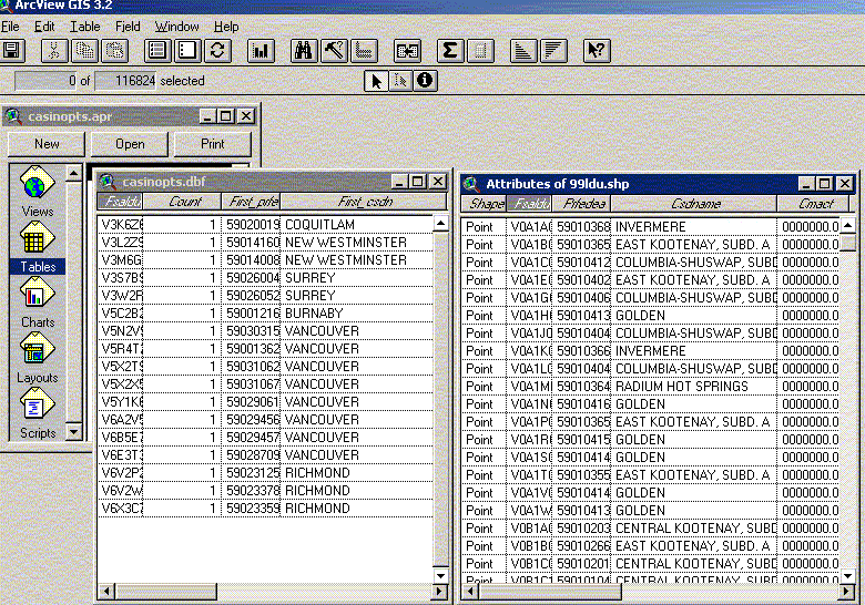
Using MICROSOFT EXCEL, I find out 19 casino's postal codes and save them as casinos_postalcode.xls then apply this excel file to save as casinopts.dbf (IV).
Step Two:
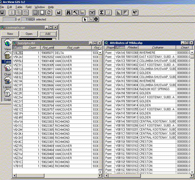
In ARCVIEW, use Table (clicking Add icon): casinopts.pdf, then highlighting,postal code column (from casinopts.dbf) and Fsauldu (which is the data from attributes of 99ldu.shp, but make sure to change the corrected projection). Then, do Join two tables of casinos.dbf and Attributes of 99ldu.shp that the 19 points of casino locations display in the shapefile (as casino_points.shp). Then go to Theme (Convert to Shapefile) in the main menu where file name types in: casino_points.shp (make sure to use appropriate projection).
Step Three:
Then, open IDRISI program, go to File (click in Import, Software-specific formats, ESRI formats, SHAPEIDR). In SHAPEIDR, there are Input shapefile:casino_points, and Output idrisi vector file: casino_points, reference: utm. Then go to Database Workshop, choose File icon (open: casino_points and table: casinos1, then in Display icon: casinos1). Finally, show all points in a layer in vector data in IDRISI.
Step Three:
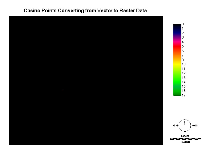
After that, go to Reform, click Raster/ vector conversion then choose POINTRAS. In POINTRAS, vector point file: casino_points, operation type: Change cells to record the identifiers of points. In IDRISI, using the file casino_points converting to casinos_ras as a raster data (by POINTRAS).
Step Five:
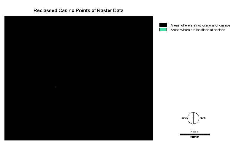
Then, do Reclass for casinos_ras to be 0 and 1, and there are several points would display on the layer with qual256 that .
Step Six:
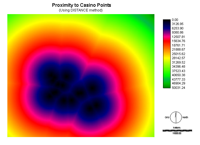
Finally, applying Distance method (from Distance Operators in Analysis icon), the feature image enters as casinos_ras_rec and output image as casinos_dis.
Step Seven:
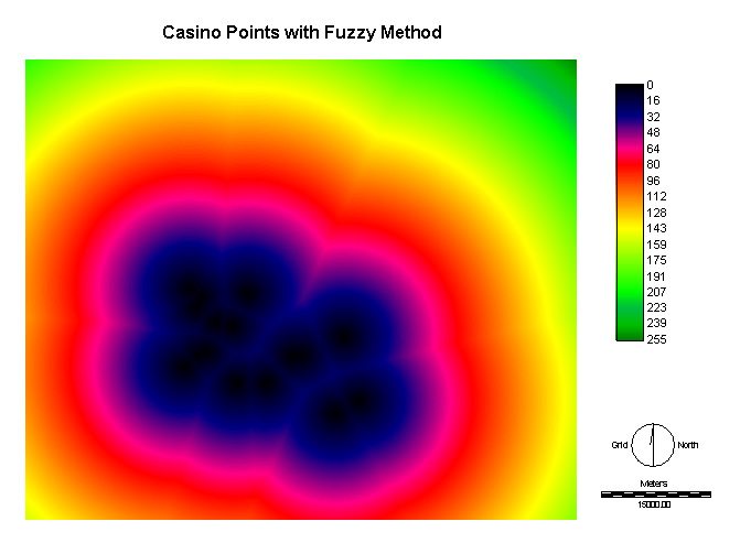
After that, use Fuzzy method (from Decision Support in Analysis icon), select the Type of function: Linear, Type of membership function: Monotonically decreasing, Control a: 0 and Control b: 50032.
-see Cartographic Models for the process of running the MCE
4. Hotels
Procedures:
Step One:
Using MICROSOFT EXCEL, find out 30 hotel's postal codes and save them as hotels_postalcode.xls then using this excel file to save as hotelpts.dbf IV). In ARCVIEW, use Table (clicking Add icon): hotelpts.pdf, then highlighting, postal code column (from hotelpts.dbf) and Fsauldu (which is the data from attributes of 99ldu.shp, but make sure to change the corrected projection). Then, do Join two tables of hotelpts.dbf and Attributes of 99ldu.shp that the 30 points of hotel locations display in the shapefile (as hotel_points.shp). After that, go to Theme (Convert to Shapefile) in the main menu then file name types in hotel_points.shp (make sure to use appropriate projection).
Step Two:
Then, open IDRISI program, go to File (click in Import, Software-specific formats, ESRI formats, SHAPEIDR). In SHAPEIDR, there are Input shapefile: hotel_points, and Output idrisi vector file: hotel_points, and reference: utm. Then go to Database Workshop, choose File icon (open: hotel_points and table: hotels1, then in Display icon: hotels1). Finally, show all points in a layer in vector data in IDRISI.
Step Three:
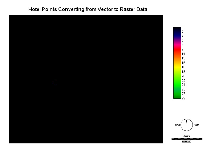
After that, go to Reform, click Raster/vector conversion then choose POINTRAS. In POINTRAS, vector point file: hotel_points, operation type: Change cells to record the identifiers of points. In, IDRISI, using the file hotel_points converting to hotels_ras as a raster data (by POINTRAS).
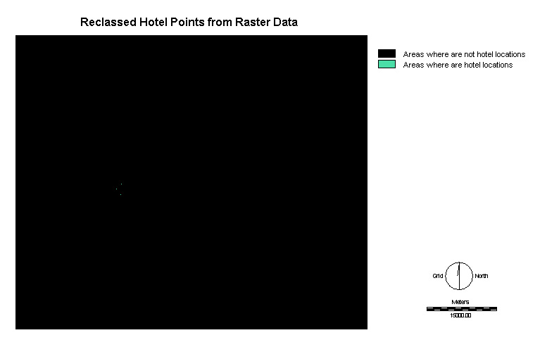
Step Four:
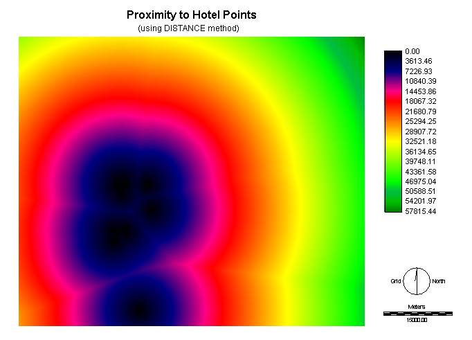
Then, do Reclass for hotels_ras to be 0 and 1, then there are several points would display on the layer with qual256. Finally, applying Distance method (from Distance Operators in Analysis icon), the feature image enters as hotels_ras and output image as hotels_dis.
Step Five:
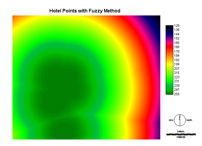
After that, use Fuzzy method (from Decision Support in Analysis icon), select the Type of function: J-shape, Type of membership function: Monotonically increasing, Control c: 3000 and Control d: 57816.
-see Cartographic Models for the process of running the MCE
5. Landuse
Procedures:
Step One:
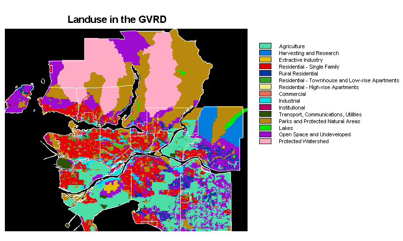
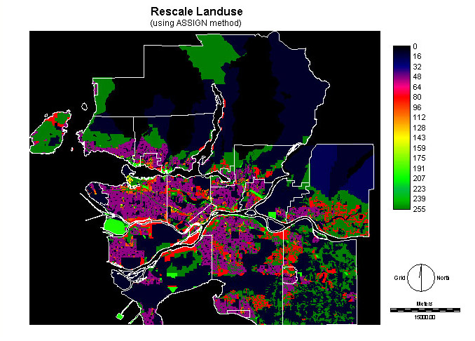
In IDRISI, open the file called landuse in the “gen” folder under “gvrd” from Geog355-Data. The map shows the whole area in GVRD to be subdivided into 15 classes.
Step Two:
At this time, I evaluate those landuses and category them into numbers, which set the minimum value as 0 to the maximum value as 255, for example, commercial and open space would be weighted 255 and 200 respectively. Then save these values as attribute value file in Edit under Analysis and do ASSIGN that is named as landuse_suit1.
Step Three:
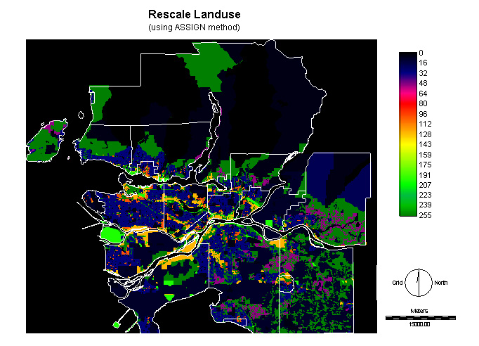
In fact, I want to create two layers of landuse_fuz files. The first one is to be set the values, like over 50, in residential classes and institutional areas, and the second is to be weighted the values under 10 to 5 in residential classes and institutional areas as well.
-see Cartographic Models for the process of running the MCE
6. Major Roads
Procedures:
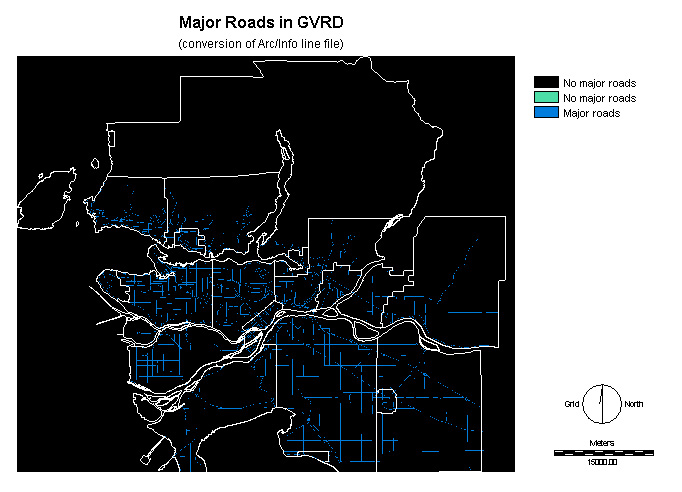
Step One:
Open IDRISI program, go to File (click in Import, Software-specific formats, ESRI formats, SHAPEIDR). In SHAPEIDR, there are Input shapefile: mjroads, and Output idrisi vector file: major_roads, and make sure the reference: utm. Then go to Reform, click Raster/ vector conversion then choose LINERAS. In LINERAS, vector point file: major_roads, operation type: Change cells to record the identifiers of points. Using the file hotel_points converting to major_roads_ras as a raster data (by LINERAS).
Step Two:
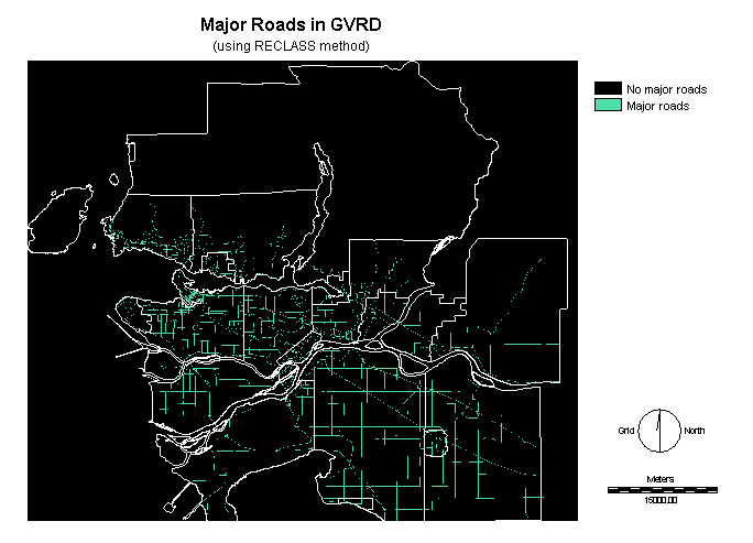
Then, do Reclass for hotels_ras to be 0 and 1, then there are several points would display on the layer with qual256.
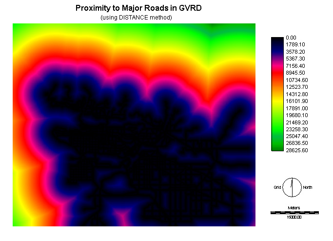
Step Three:
After that, apply Distance method (from Distance Operators in Analysis icon), the feature image enters as major-roads_ras and output image as major_roads_dis.
Step Four:
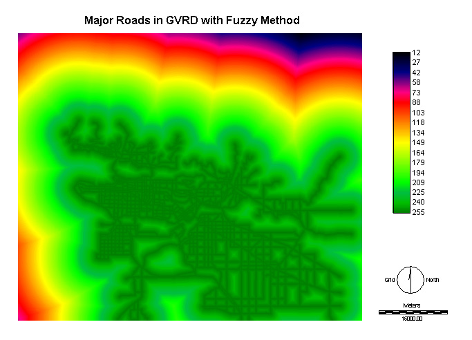
Finally, use Fuzzy method (from Decision Support in Analysis icon), and select the Type of function: Linear, Type of membership function: Monotonically increasing, Control c: 0 and Control d: 28626.
-see Cartographic Models for the process of running the MCE