Results of my Spatial Analysis

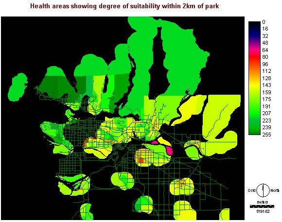
The final image is a measure of aggregate suitability
that ranges from 0-255 for non-constrained locations. The factors once
again that inflenced health are: income, university education, ownership
of dwelling and percent employed. The constraint was that healthier
people would live within a 2km distance of a park equal to or greater than
one square kilometers. The results confirm my hypothesis that areas
having higher degrees of health are located near parks.
A road vector layer was superimposed ontop of both the
resulting image (image 1) and the base map image (image 2) for comparison
purposes.
Image 1 - The final result:
Image 2:


