Click on an image to see a larger version
The Methodology section outlines the process used to build the tsunami models and in this section I look at how the model fits the archeological records. To overlay the site information, I digitized each site with a different layer for each attribute and laid them on top to look for areas where the site values conflicted with the model. One example of a conflict would be a site located in an area not identified by the model. For each site, Deirdre and I dated the layers of tsunami evidence relative to cultural layers that were previously dated by the researchers. These sites were then organized into layers, by the dates of the tsunami records, and were then overlaid onto each model. The white dots in each image indicate a site.
Click on an image to see a larger version
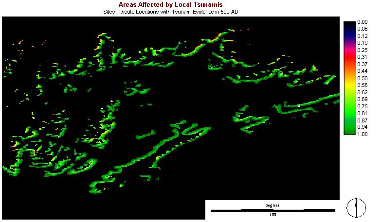
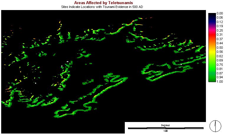
Both of these images use the same sites with the same date (500 AD) of the tsunami records and the local model (the first image) has more sites within the modeled area than the second image. This may suggest a local tsunami had a higher probability of leaving these deposits. Two sites in the middle of the image were, however missed by both models.
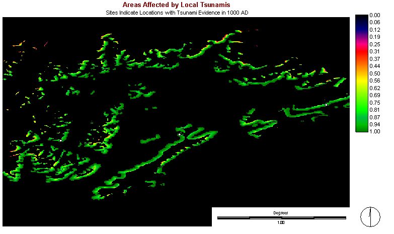
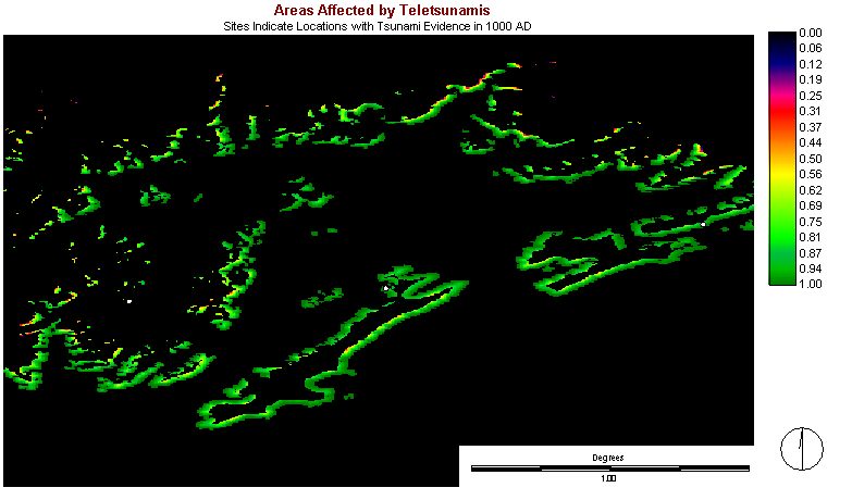
The sites in these images represent tsunami deposits from 1000 AD and have similar results as above. The image of the local tsunami model (on the left) has a higher success representing the three archeological sites containing tsunami deposits.
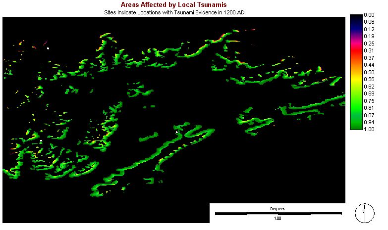
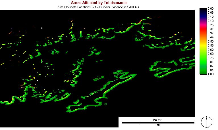
The sites laid on the two models represent deposits from 1200 AD. The local model (again on the left) contains two out of three sites for this layer and the teletsunami model only contains one of the three sites.
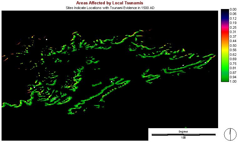

In this case, where the sites date from about 1500 AD, the teletsunami model (on the right) successfully contains five of the six sites, whereas, the local model only contains three of the five sites.
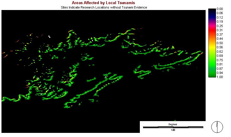
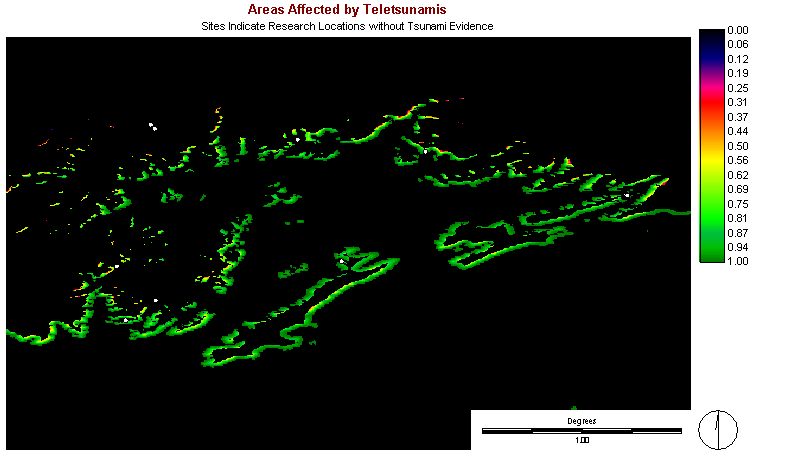
Here the two models are overlaid
with sites that have had no tsunami activity, according to their stratigraphy.
The local model has three of the ten sites contained in areas modeled to
have been affected by tsunami activity. The teletsunami model has
two of the ten sites contained in affected areas. In this case success
would be indicated by a model with the fewest sites contained within areas
affected by tsunami activity.