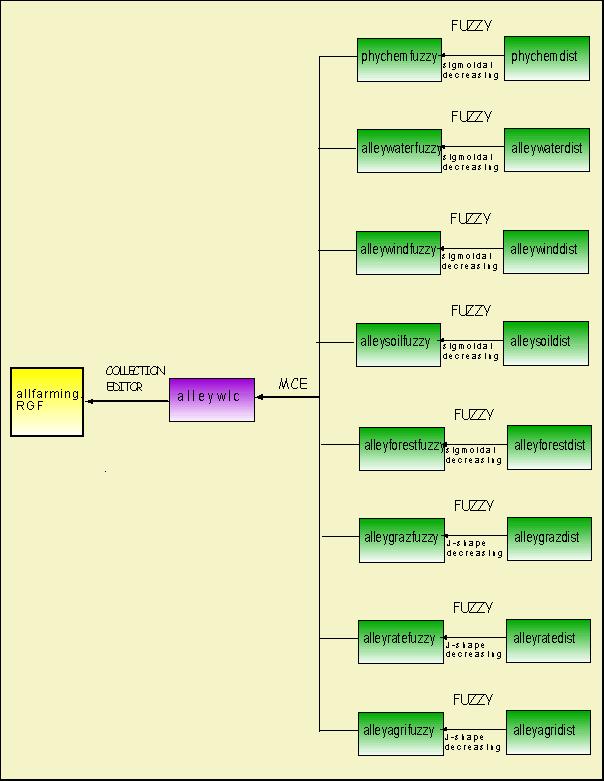
The 8 factors that weighted into the Multiple Criteria Evaluation (MCE)
The
procedures for creating the MCE map
I arrange all the DISTANCE
maps into FUZZY operation, then put all the layers into WEIGHT and MCE.
After I get the map "alleywlc", I put all the files into the COLLECTION
EDITOR for creating a raster group file.
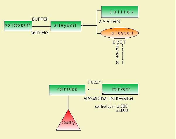
In order to process the
fuzzy maps, I have assigned the control points as follow:
phychemfuzzy:
control point c: 2.25
d: 17.99
alleywaterfuzzy:
control point c: 1.52
d: 17.99
alleywindfuzzy:
control point c: 2.44
d: 17.07
alleysoilfuzzy:
control point c: 1.14
d:18.64
alleyforestfuzzy:
contol point c: 1.44
d: 21.93
alleygrazfuzzy:
control point c :1.31
d: 20.75
alleyratefuzzy:
control point c: 1.50
d: 20.24
alleyagrifuzzy:
control point c: 2.31
d: 23.05
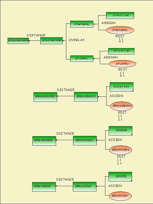
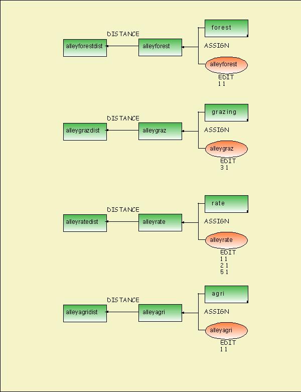
The cartographic models of other maps
 Want
to go back to index?? click here
Want
to go back to index?? click here
Go next??click here