Creating Catchment Areas for Existing
Palliative Care Services
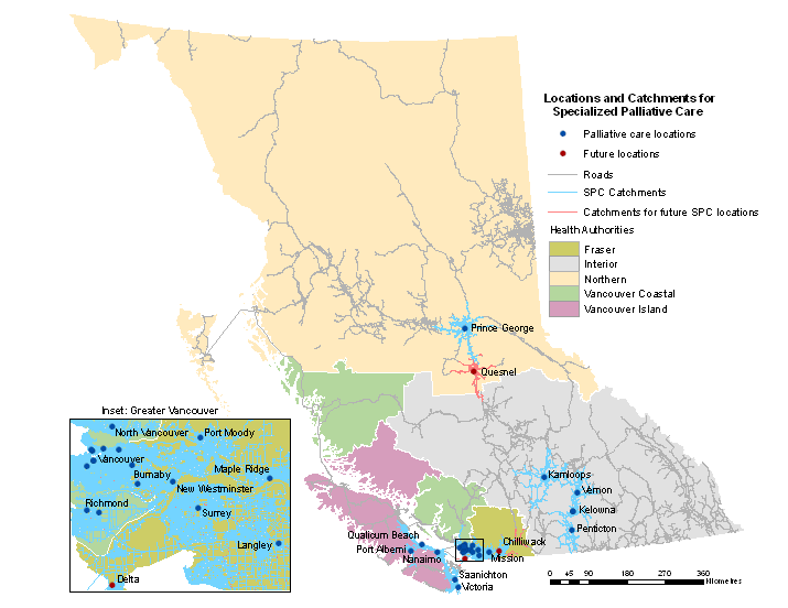
Spatial accessibility to current palliative care service locations was
determined by creating catchment areas for existing services. These catchments
were created using a vector GIS method based on a travel-time from residence to
site of care based on a travel-time of 1 hour. The map of road-network based
catchments for current palliative care services in BC is shown below. Blue
catchments represent the 1 hour travel-time service areas for existing
services, red catchments represent the service areas for future locations.


