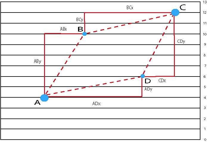
Figure 23: A hypothetical planar surface on which there is a perfect correlation between elevation and precipitation. As a result the horizontal isolines represent increasing elevation and increasing precipitation. Points A and C are known stations. Unsampled points B and D can be interpolated from points A and C by using distances ABy and BCy for estimation at point B and ADy and CDy for estimation at point D. In this idealized scenario, it would not be necessary to consider two-dimensional distance in the interpolation.