|
The
Lake Tahoe Basin:
(map)
Maximum Depth: 501
m Average Depth: 305
m
Diameter
Max: 35 km (N - S) Min:
19 km (E - W)
Surface
Area: 495 km^2
Average Elevation:1,897
m
Lake Tahoe is the
second deepest lake in the United
States and the eleventh deepest
in the world. It is a freshwater
lake lying between California
and Nevada that was formed by
normal block faulting roughly
2 million years ago. While uplifting
created the Carson and Sierra
Nevada Ranges, down-dropped blocks
created the Lake Tahoe Basin lying
in between. The physical landscape
of the basin as we know it today
was primarily formed by the movement
of massive continental glaciers.
Physical alteration of the landscape
continues under the influence
of climate and human development.
(USGS
DEM)
Soils of the Basin are largely
granitic, having derived from
Granodiorite as well as volcanic
Andesite. In some areas (primarily
at higher elevations) the Granodiorite
and other metamorphic rocks remain
unweathered and exposed at the
surface. On the lower slopes and
in the valleys of the Basin, well-drained
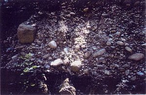
colluvial soils dominate.These
are formed from glacial outwash.

Glacial
outwash profile (>65%gravel)
Climate in the area ranges from
sub-arid (annual precipitation
approx. 65cm) on the eastern extremity
of the basin to sub-humid (approx.
140cm) on the west, with most
precipitation falling as snow.
This is indicative of large annual
run-offs coinciding with the spring
melt of the snowpack. Over 25
streams drain into the lake, while
only one, the Truckee River, flows
out. Vegetation in the Basin varies
with precipitation and soil type.
A large part of the area is dominated
by a mixed-coniferous forest consisting
of both Jeffery and Lodgepole
Pine as well as White and Red
Firs. Large areas of ecologically
sensitive wetland meadows and
riparian zones bordering the many
streams and rivers are also present.
Many dry meadows can be found
close by areas of rock outcrop.

Wet
Meadow
NEXT
(1
of 2)
|