 |
||||||
Discussion
The cost surfaces that were produced yielded some very interesting linear cost distances which reflect the misleading nature of calculating cost as the crow flies. These surfaces suggest that there is a significant cost in travelling to the Georgia Strait from most places in the Fraser River region. These linear distances do not consider the topography or the river in generating the surface. A least cost surface wold be more appropriate for this type of analysis and should not be considered using the cost surfaces that were provided. The only exception to this is the archaeological site located in the Tswassenn region (site 139) of the Lower Mainland, where the cost of travel is very directional and radiates equally in this direction for a large distance. This also displayes the great deal of access that water based travel had to the Georgia Strait region, which ethnographically was a prolific as the cost surface emphasises (Suttles, 1990). Leaving the flats of the Lower Fraser and GVRD, the cost surfaces do not work well with the dendridic network of valleys in the Upper Fraser and the Fraser Canyon.
The least cost pathways that were created using the small 10 site sample show some very stiking pattens regarding the favoured routes when on the water and when not having access to the water based travel.
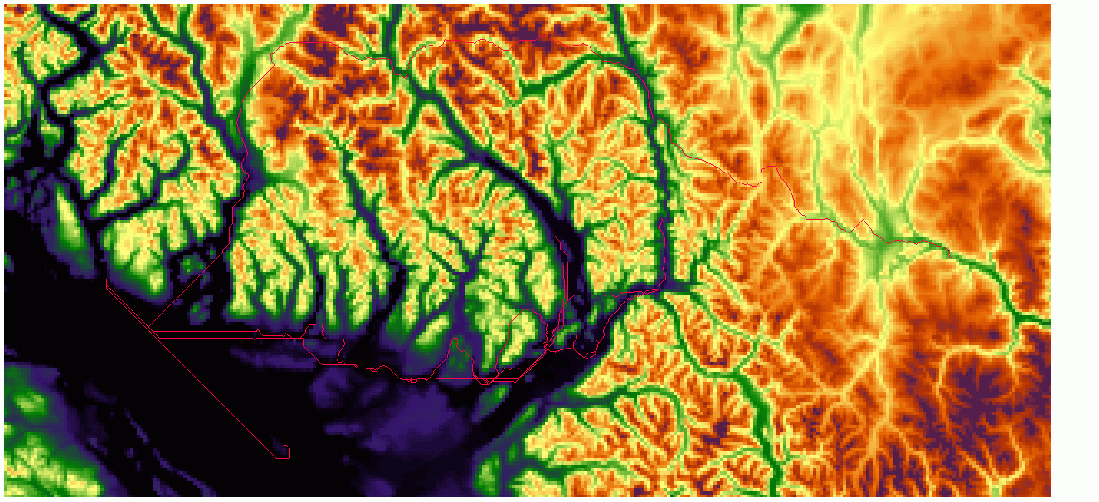
 DEM of the Study Region with the low friction river least cost pathways overlaid
The above image does an excellent job of outlining the general trends in the routing of these least cost pathways. Of great interest is the pathway that moves across the northern part of the map, crossing almost the entire map. This routing follows the known rivers to a great extent but may overly emphasize small, first and second order streams that may have been included. This outlier may fall to far away from the Fraser River to be included in this water borne tradtition of the region.
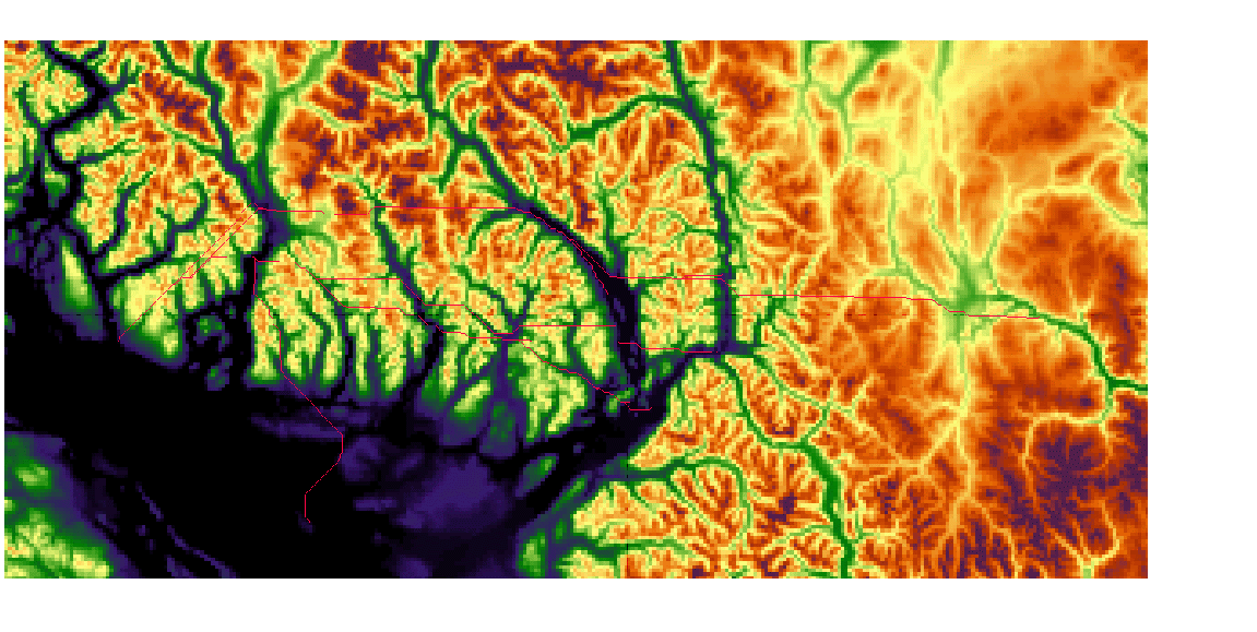
 DEM of the Study Region with the significant river friction least cost pathways overlaid
This image represents significant river friction least cost pathways shows the general trend towards travelling across the mountainous region instead of staying toward the Fraser River and the valley. This probably represents the need to cross the inlet to the east of the pathway end point in the west. As mentioned in the problems page, these paths cross the rivers at the most narrow point which may not be logical when considering rivers are most likely to be moving the most quickly at these points.
These images imply that those that would not have access to the relatively effiecent river travel network would be best servered to travel across the mountains and hills in a more direct path instead of following the river to the ocean shore, then follow the shore and island hop north.
Another interesting caviat of this method is that this route minimizes the crossing of rivers as well as all other bodies of water, which would be the route that someone on foot would utilise.