The original data came in ArcView shapefile (vector
format), and contained only mean annual precipitation contours
for the island of Maui. To create a continous
precipitation surface, the vector file was rasterized in IDRISI.
Next, the
raster image was reclassed to assign appropriate
values to raster cells (the problem was that they retained original
id's of isolines, and not the values represented
by isolines). The resulting reclassed image was converted from real
to integer data type. Finally, INTERCON
module performed the intercontour interpolation to derive rainfall surface.
The countours were not complete, so interpollation
failed toard the ends of contours.
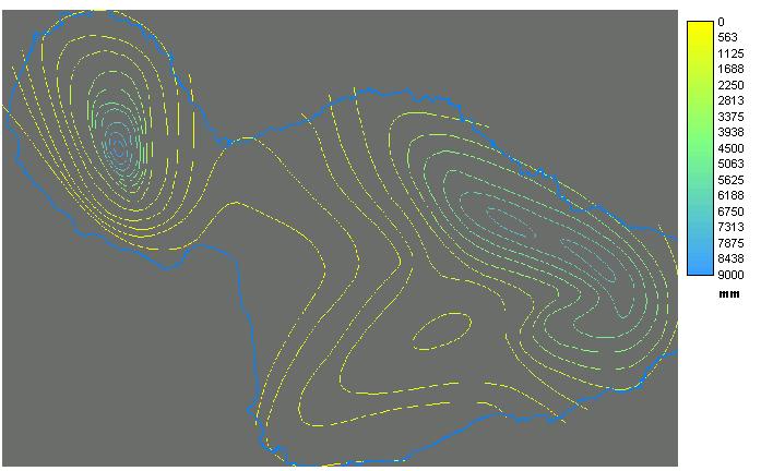
Here is the reclassed raster image showing isolines:
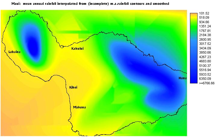
Here is the interpolated surface:
Comments:
The driest coastlines on Maui are on the south-west
side of the island and stretch from Lahaina to Makena. The northern
coasts are much wetter as they receive most of
the trade winds and incoming weather. The wetest coast is along the
Hana Highway on the north-east side of Maui.
Most of the beach resorts are located in dry coasts.