![]()
![]()
![]()
![]()
![]()
![]()
Project Design
This project design is to analyse what area would be suitable and meet specific parameters to open a new high-tech liquor store.
I have think of 3 important factors that will affect the analysis.
Economic
factors
To attract more people to the high-tech liquor store, the analysis parameters must include:
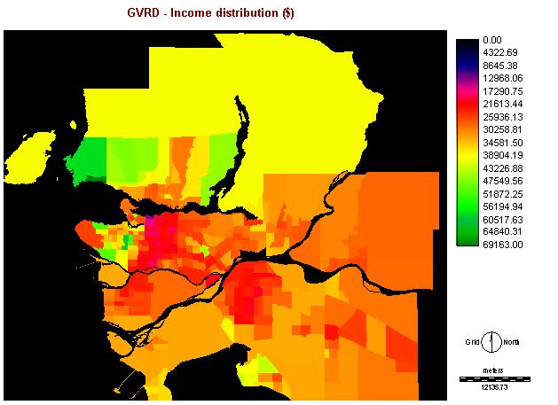
1. Average income
Basically, alcoholic beverages are count as luxury goods. So, higher income has higher potential and power to spend their money on it.
Method: I convert the mdb file (table13ct) to dbf file in Access and ASSIGN the data with the image ct96
Cartographic
Model:
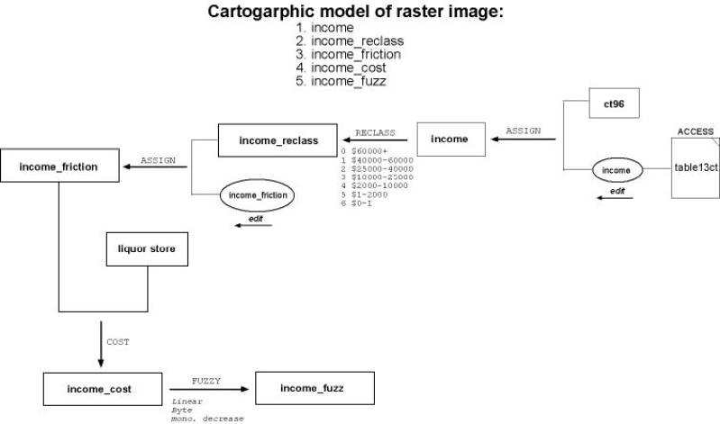
Image:
2. Money spend on buying alcohol
beverages in a liquor store
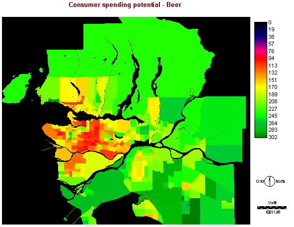
CSP for beer within a range. (ie. Areas of high beer CSP) I have produce 3 different alcoholic beverages from the data.
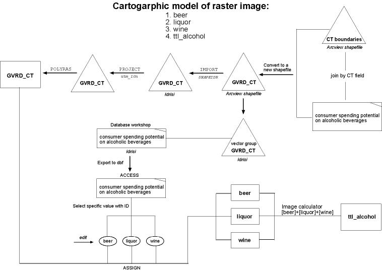
a) beer -
money spent on buying beer
Method: After import the shapefile GVRD_CT into Idrisi, I have to PROJECT it to utm_10n. Then I use the data in the vector group file GVRD_CT and export the data I need with the specific ID Idrisi generate. After, I can use the ASSIGN function to create the image
Image:
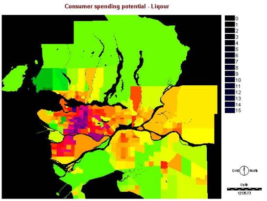
b) liquor
- money spent on buying liquor
Method: same as beer
Image:
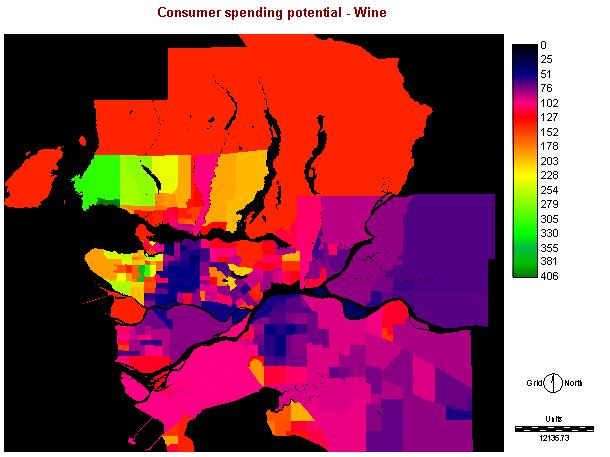
c) wine -
money spent on buying wine
Method: same as beer
Image:
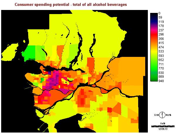
d) total
of all the above (ttl_alcohol) - beer + liquor + wine
Method: using IMAGE CACULATOR to do the operation of adding.
Image:
Social factors
To avoid people tend to be easier to get addicted to alcohol, the analysis would include:
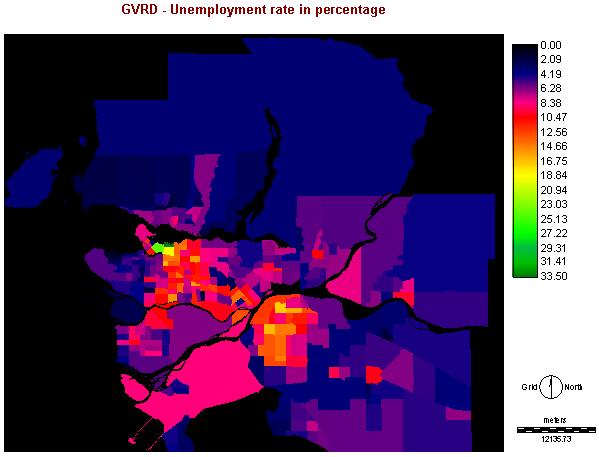
1. Unemployment
rate (%)
Areas that have the least unemployment rate so that it will eliminate people using alcohol when depress.
Method: I convert the mdb file (table7ct) to dbf file in Access and ASSIGN the data with the image ct96
Cartographic Model _ unemploy:
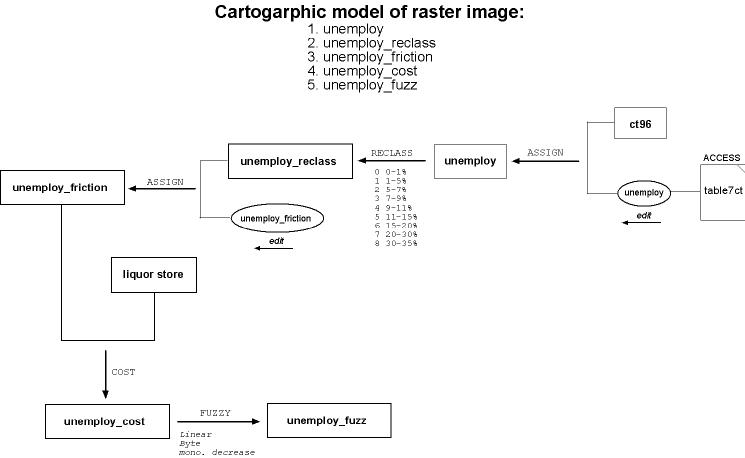
Image:
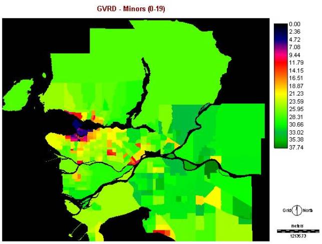
2. Percentage of
Minors (age 0-19)
Areas that have
the least minors so that will eliminate the children from buying alcohol.
Method: I convert the mdb file (table1ct) to dbf file in Access and do some summation of the all the age group and convert them in to percentage and then ASSIGN the data with the image ct96.
Cartographic
Model_minor:
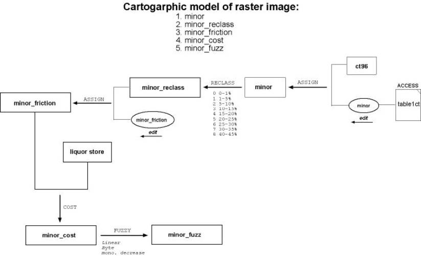
Image:
Spatial factors
To avoid some unsuitable area or near some suitable area, the following criteria has been included in the analysis:
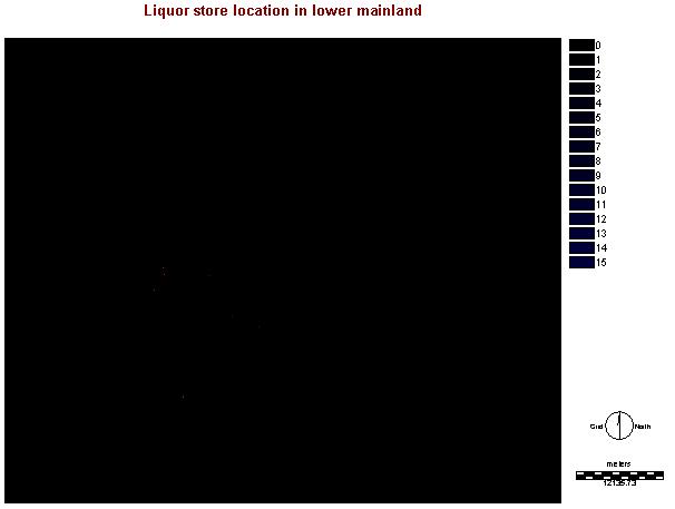
1. Other liquor store location
To avoid self competition, I will try to avoid to place the new store near to the existing stores. e.g. Has to be x amount of km away from adjacent liquor stores to eliminate unwanted competition.
Method: Import the store location from Arcview.
Cartographic
Model:
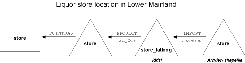
Image: Might be not able to see because of low resolution of Jpeg
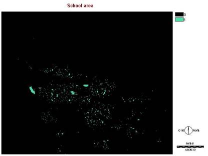
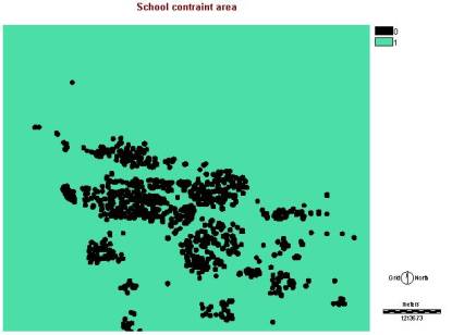
2. Location of school
Must be x amount
of km away from schools to avoid minors from buying alcohol.
Method: I use the landuse image and find out the legend of the school and use edit to create a attribute value file. Then using ASSIGN to make schoolbool. Because I want the new store away from the school at least 500m, I put 500m BUFFER on it and assign 0 for school area, 0 for buffer area, 1 for non-buffer area.
Cartographic
Model:
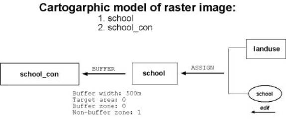
Image:
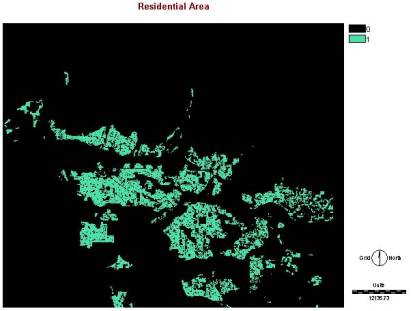
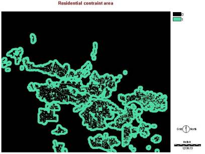
3. Residential area
Not a suitable zone for a liquor store, but don't want to be far away from it for convenience of customers .
Method: I use the landuse image and find out the legend of the residential areas and use edit to create a attribute value file. Then using ASSIGN to make resareabool. Because I want the new store away from the residential area at least 1000m, but don't want it to be that far away. I put 1000m BUFFER on it and assign 0 for residential area, 1 for buffer area, 0 for non-buffer area.
Cartographic
Model:
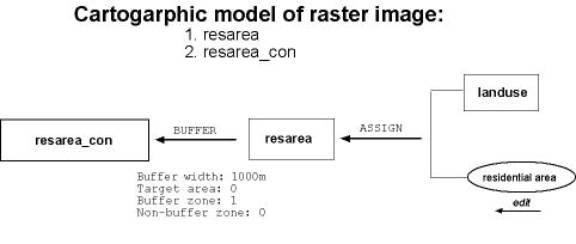
Image:
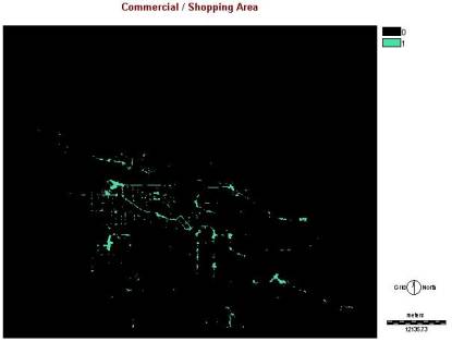
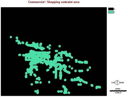
4. Commercial/shopping area
Area where more people walk by.
Method: I use the landuse image and find out the legend of the commercial/shopping areas and use edit to create a attribute value file. Then using ASSIGN to make shopcenbool. Because I want the new store within the commercial/shopping area at least 800m. I put 800m BUFFER on it and assign 1 for commercial/shopping area, 1 for buffer area, 0 for non-buffer area.
Cartographic Model:

Image: