See
the Cartographic Model used to derive these
images
See
the Cartographic Model used to derive these
images
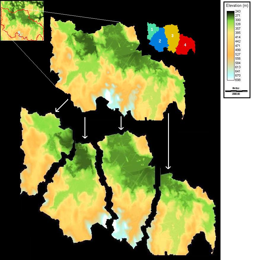
After running a series of tests with the watershed module set with different thresholds, I determined that the four watersheds illustrated above were the four largest complete watersheds in this DEM. I separated them and looked at each separately to determine which would be the most suitable basin to use. I eliminated watershed 4 because, despite being processed as a complete watershed, it seems part of the basin is just outside the DEM's boundary. I eliminated watershed 3 due to the irregularities present in the lowland portion of the DEM. I chose watershed 2 over watershed 1 because they both appeared to be suitable but watershed 2 is larger.