Above:
Crosstab results
Result:
Peak Flow Discharge = 133.1
m3/s
Detailed Results
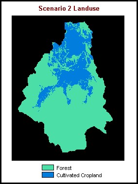
This scenario is a hypothetical situation in which the entire watershed is either forest or crop land. In this model, humans have cleared an extensive region of the basin for cultivation - all land less than 350m and either flat or rolling terrain, representing 27.1 % of the total area, has been consumed by agriculture.
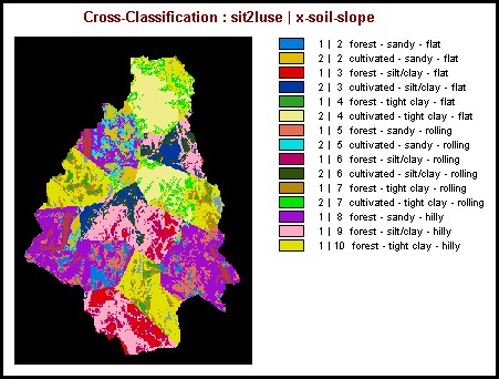
The process of analysis was exactly the same as scenario 1. The CROSSTAB module was used to identify all the unique combinations of landuse, soil and slope layer categories. Since crosstab results between soil and slope layers had already been developed in scenario one, only one crosstab operation was required, between those results (X-SOIL-SLOPE) and the scenario 2 landuse layer (SIT2LUSE). The resulting crosstab classes were entered into an Excel table. After running the AREA module, the area values were then entered into the table as well. Excel was used to perform the last steps: calculating the proportional area of each class, calculating the weighted runoff coefficient of each class and then summing them to give the coefficient of runoff for the entire basin.
Above:
Crosstab results
Result:
Peak Flow Discharge = 133.1
m3/s
Detailed Results