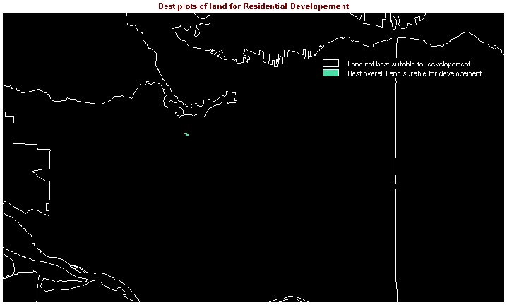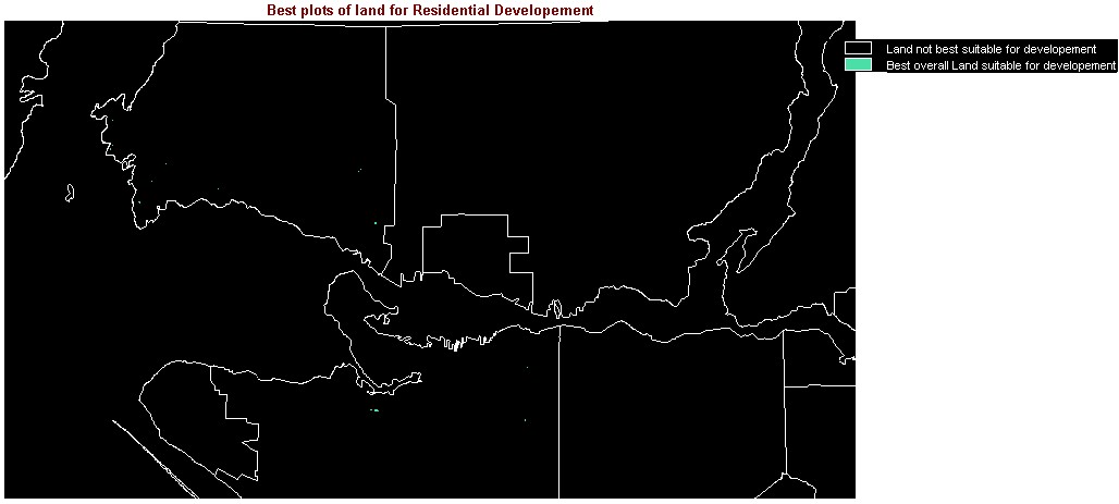
The results of the analysis were someone surprising. As predicted, few of the spots which met all the criteria were located in Vancouver as well as out in the suburbs (Maple Ridge). However, I was surprised with a couple of the aspects. Firstly, I was surprised that there were so few locations that would allow for residential developement, even with the strict criteria. As is noticed, it is difficult to see the results (BESTOVERALL and BESTOVERALL2). Overlaying another layer (City) helps put the areas in perspective. But to get the full aspect of the analysis, I had to zoom into the region around Vancouver and West Vancouver. I was also surprised to see the West Vancouver had a couple of areas meeting all criteria, when using GVRDBESTSLOPE as one of the MCE images used. Since the whole municipality is situated on a mountain, my initial guess would be that the steepness of the slopes would have been too much, which was the case when GVRDBESTSLOPE2 was used to do a MCE. Ultimately, the original images of BESTOVERALL and BESTOVERALL2 gave me five and two choices to choose from, respectively. But when the images were zoomed in, there were more choices to choose from.
When looking at the unzoomed BESTOVERALL, the five potential sites are fairly spread out. When the City layer is added to the image, it is possible to tell that two areas are in West Vancouver, two are in Vancouver and one is in Maple Ridge (One of the sites in West Van is obscured due to the CITY layer). In terms of proximity to the city centre, all points except for the area in Maple Ridge are close. However, due to traffic problems associated with traveling to and from West Vancouver, that leaves only the two areas in Vancouver to choose from. In terms of proximty to the centre of the city, the most western point located in Vancouver would be the best choice. However, there is another factor involved. The price to develope within Vancouver and the average housing prices in the city are far more expensive then developing or buying a house in Maple Ridge. West Vancouver is the most expensive so again, those two areas are not going to be chosen. However, Maple Ridge is a long distance away from the city and living out there would require lots of driving, especially if the potential homeowner works in the city. But based on distance and cost, the best place, in my opinion, would be the eastern most point located in Vancouver.
The situation changes slightly when the zoomed image is viewed (BESTOVERALL_A). Since the land plots that are visible fall within the Vancouver and the West Vancouver, it makes the final decision easier. As previously mentioned, the cost and the traffic scenarios are major factors for not chosing to build in West Van. There are a couple more sights that are shown within Vancouver but again, development and housing costs discourage building near the city centre. The best overall place to build is change to the south-east most land plot. This was chosen because it further away from the centre of the city yet not too close to streets such as Hastings, as the point to north of it suggests.
The cost to develope would be higher, but it would
likely be cheaper than the other Vancouver site. Also, it is still within
Vancouver so the travel time and distance to the city centre is minimal,
unlike the site in Maple Ridge. When using the original image BESTOVERALL2,
the only areas that are choosen are the location in Maple Ridge and the
western most point in Vancouver. Given this situation. I would pick the
Vancouver site over the Maple Ridge site. I would choose this site because
even though the resulting residential dwelling would be more expensive,
the demand would still be there. That location is real close to the city
centre and is quite accessable by either walking, biking, busing or driving.
While cheaper, the Maple Ridge location is too far away from the city centre.
In addition, in the event of a natural disaster, the chances of emergency
and utility workers coming to aid victims would most likely reach and be
available in the city rather than in the suburbs. This site is visible
when the BESTOVERALL2 image is zoomed in (BESTOVERALL2_A).