|
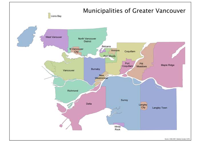
In order to create a map of population density for our study region, we have used suitable data that encompasses the entire reaches of the region. The region in question is the Lower Mainland of Vancouver. Politically, or perhaps administratively, this is defined as the Greater Vancouver Regional District (GVRD). The GVRD extends from Bowen Island in the west to Maple Ridge in the east, and from North Vancouver to the US border. This region is very familiar to those who have spent much of their lives residing in it. The diverse cultures, communities, and people found in the Lower Mainland makeup the basis for our study. More populated areas such as the Lonsdale corridor, the downtown core, or the Metrotown area of Burnaby are evident as denser places. Rural communities, such as eastern Richmond and the southern portions of Surrey, such as Cloverdale, show that populations are sparse and distributed over the area. These are types of conclusions that are visually conveyed using cartographic representation (in two and three dimensions).
|