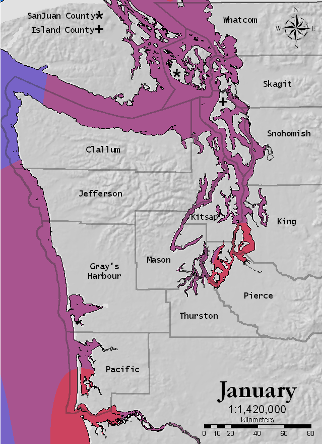
Average Monthly Water Temperature for Washington Coast
This map shows the changes in water temperature through the year. The coldest water is in the northwest corner of the peninsula. This is the third time that this area has been identified as high risk. Once again there are indications thats summer is a safer time due to warmer water temperatures.