Methodology Step 4:
Step 4:
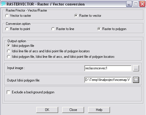
In order to be able to view the finished MCE product with the base map in ArcGIS, the RASTERVECTOR operation in Idrisi must be used to change the MCE into a vector layer.
Methodology Step 4: |
|||
Step 4: In order to be able to view the finished MCE product with the base map in ArcGIS, the RASTERVECTOR operation in Idrisi must be used to change the MCE into a vector layer.
|
|||
|
|||
| Once the MCE is a vector layer, it can then be converted and exported from Idrisi as a shape file. The new vector shape file can then be added to the base map in ArcGIS and observed for patterns and zones of high risk environmental factors. Analysis and conclusions can now start to be drawn, but first we will look at the additional sub-factor methodology. | |||